
OUR SERVICES
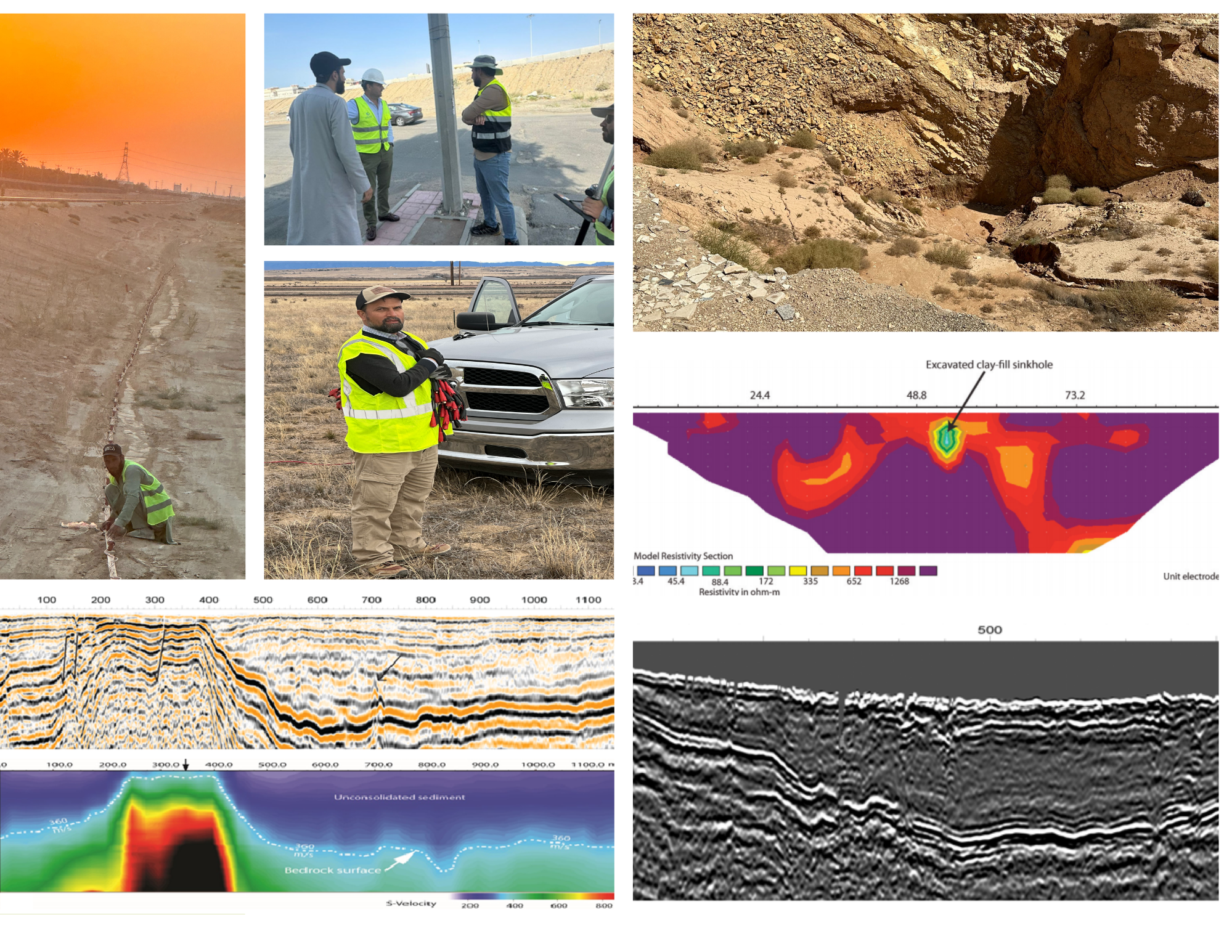
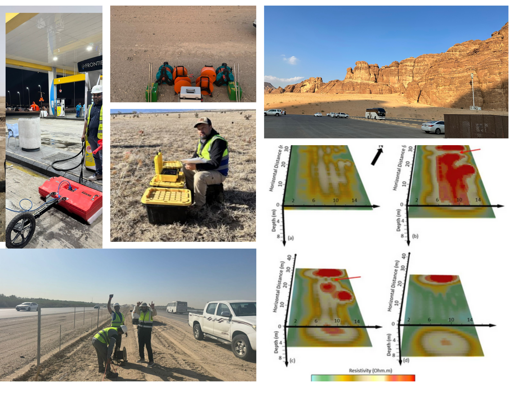
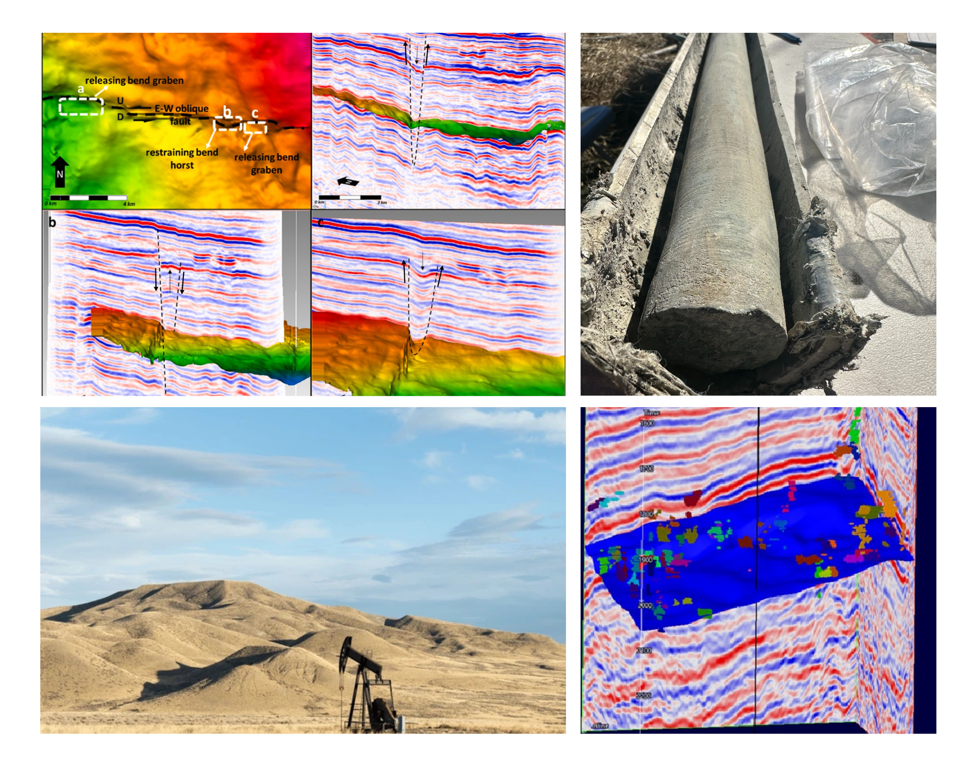
Engineering Geophysics
Soil Moisture Content
Foundation Risk Assessment
Slope stability and landslide evaluation
Faults, Fractures, Weathered Zones Mapping
Foundation Integrity and Disturbed Zones
Mapping Pavement and Concrete Thickness
GPR Utility Detection and Clearance
Soil Resistivity Testing (4-Wenner Array)
Bridge deck inspection
Shear-Wave Velocity (Vs)
Compressional-Wave Velocity (Vp)
Void and Karst Detection
Groundwater Mapping
Bearing Capacity
Soil Amplification
Soil Amplification Maps
Vs30, Vs20, Vs10
Seismic Site Classification
Geological Characterisation
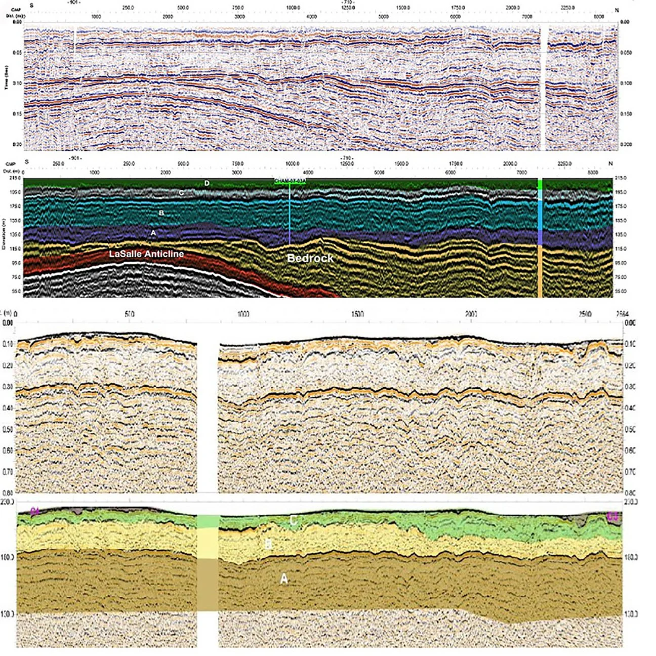
Geologic mapping
Fault mapping
Locating shallow sand and gravel deposits
Delineating steeply dipping geologic contacts
Mapping subsurface fractures
Environmental Geophysics
Mapping contaminant plumes
Contaminant source identification
Locating and mapping landfills
Karst Mapping
Waste management and natural hazards mapping
Post-closure landfill inspection and monitoring
CO2 sequestration monitoring, and landfills and industrial site selection
Dams & Landfills
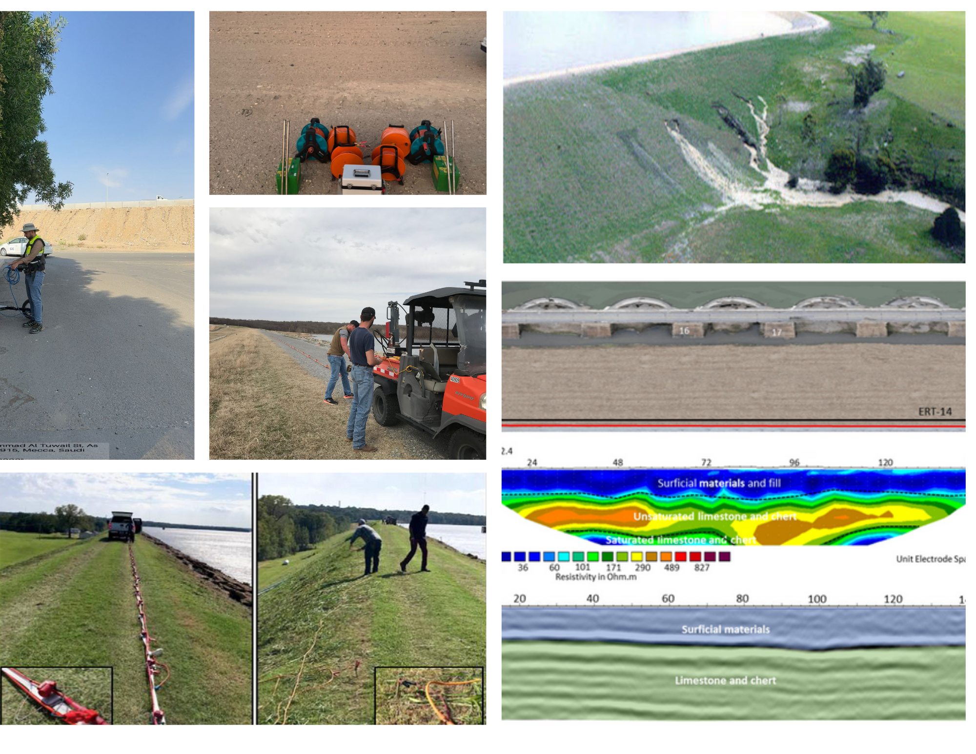
Seepage paths detection
Foundation investigations
Identifying weak layers
Potential for liquefaction
Identifying bedrock depth
Delineating subsurface faults
Voids or tunnels detection
Buried utilities under dams
Mapping groundwater levels
Utility Detection
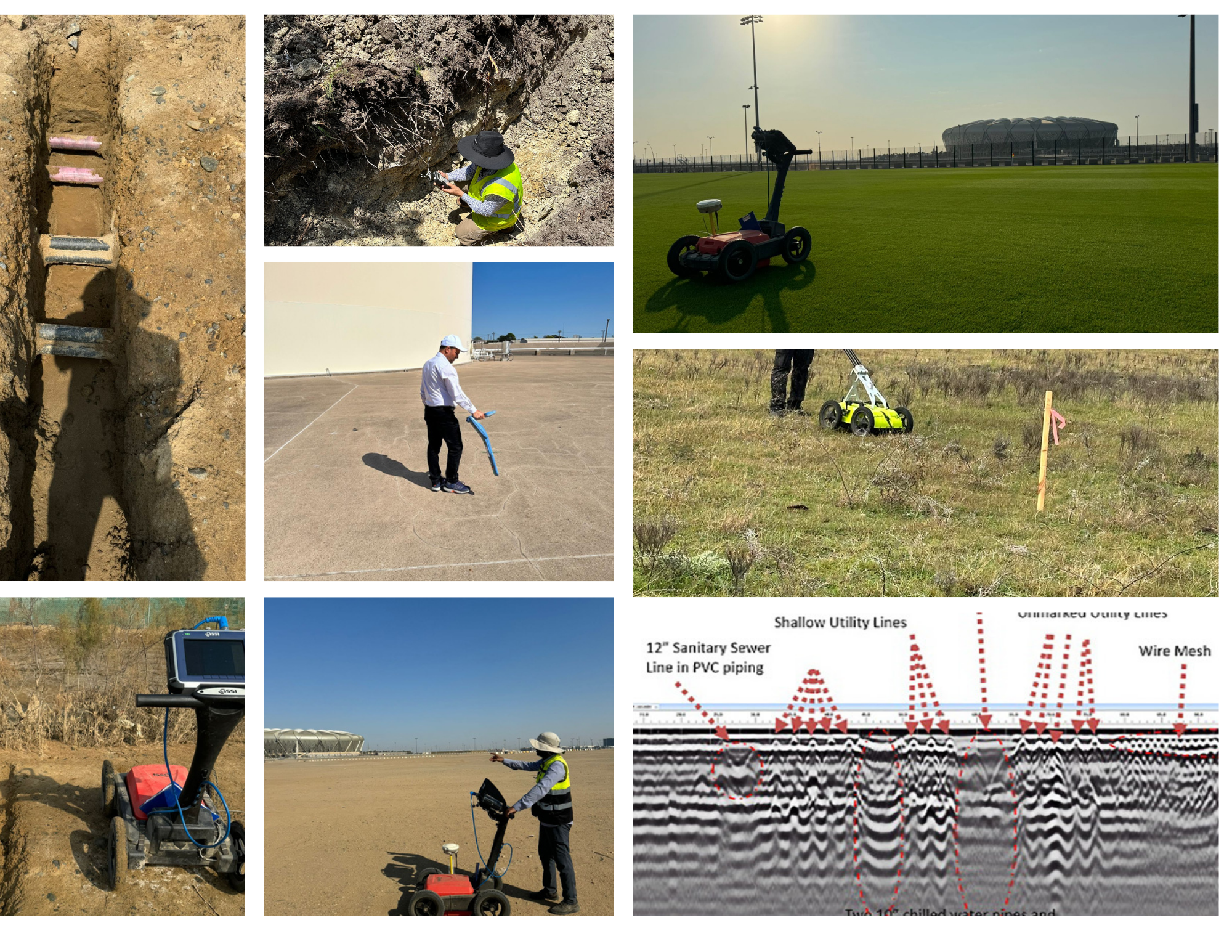
Cables, pipes, and conduits detection
Potential leaks from pipes
Utility conflict resolution
Sanitary sewer line detection
Locating utilities before major construction or renovation projects
Assessing the condition of buried pipelines, detecting anomalies, corrosion, or structural issues
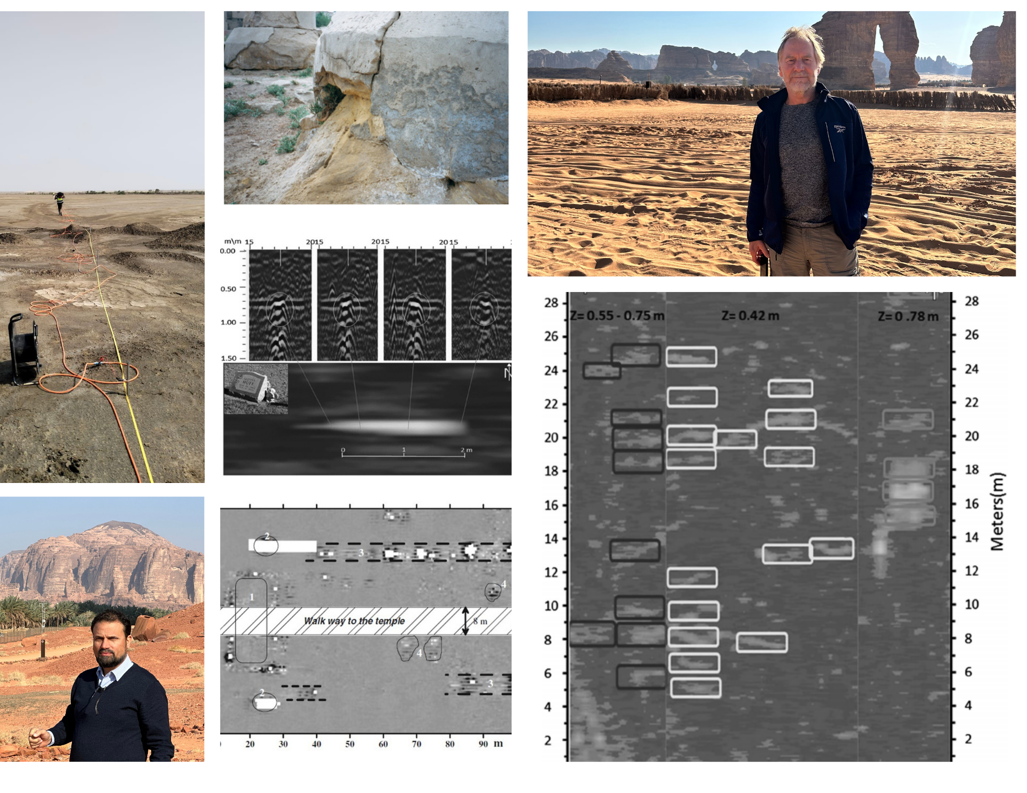
Archeological
Non-invasive archeological prospecting
Identifying potential excavation targets and prioritizing areas for further investigation
Identifying traces of past human activities
Locating buried chambers, tunnels, or voids associated with ancient structures
Detecting ancient landscape topography and features such as ancient roads and shorelines
Identifying buried walls, foundations, ancient structures tombs, and gravesites
Forensic investigations
Detecting unmarked graves
Mineral Exploration
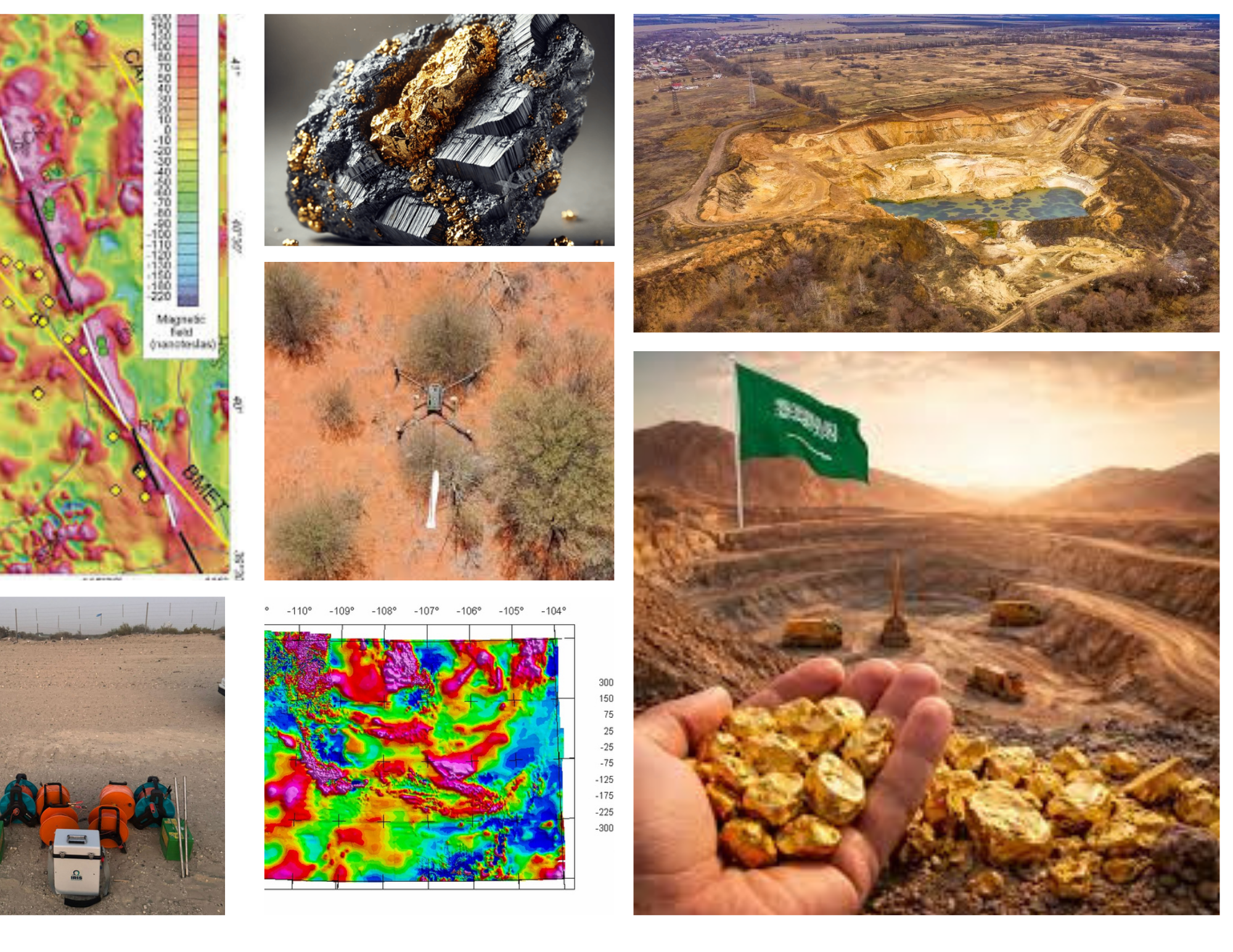
Regional mineral prospecting and target generation
Ore body detection and delineation
Structural mapping (faults and shear zones)
Alteration system mapping
Sulfide and conductive mineralization detection
Magnetic and density contrast mapping
Basement and crystalline shield mapping
Volcanogenic massive sulfide (VMS) exploration
Gold exploration (orogenic and shear-zone hosted)
Base metal exploration (copper, zinc, lead)
Iron ore exploration
Phosphate exploration
Bauxite exploration
Rare earth element (REE) exploration
Exploration drilling optimization and targeting
Groundwater Management
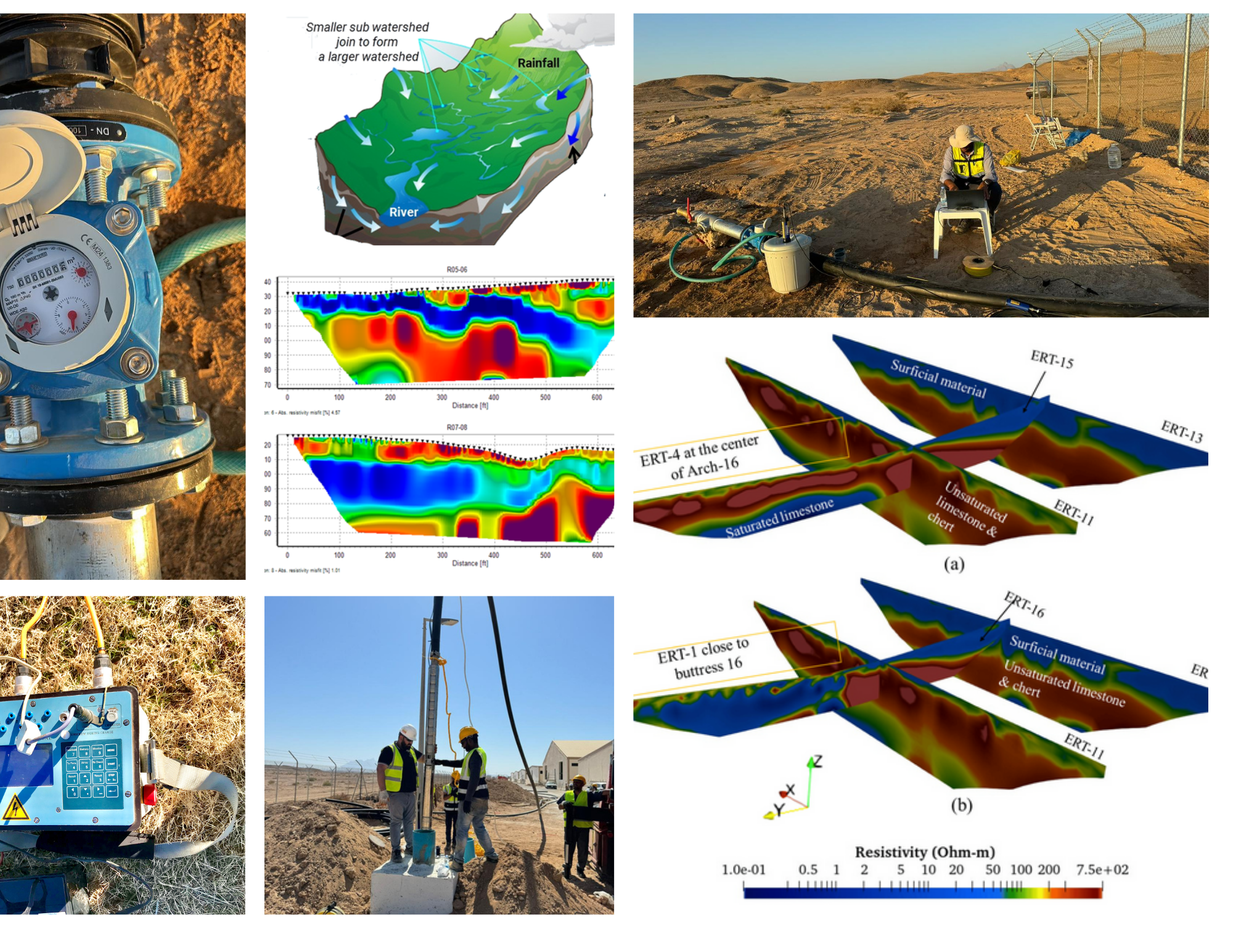
Groundwater exploration and assessment
Aquifer characterization and 3D modeling
2D and 3D seepage analysis
Groundwater rise assessment
Design of deep well dewatering systems
Design of wellpoint systems
Design of subsurface drainage systems
Pumping and step-drawdown test analysis
Well efficiency and performance evaluation
Aquifer recharge feasibility assessment
Aquifer Storage and Recovery evaluation
Contaminant transport modeling
Saltwater intrusion assessment
Groundwater vulnerability assessment
Groundwater recharge and sustainability
Regulatory Review & Compliance Support
Energy
Assist clients in selecting the most suitable geophysical contractors for their specific seismic exploration or sequestration projects.
Facilitate communication and coordination with Geophysical Contractors on behalf of clients.
Supervise the contractor’s processing of 2D/3D conventional and multicomponent seismic data on behalf of clients.
Surface Water Management
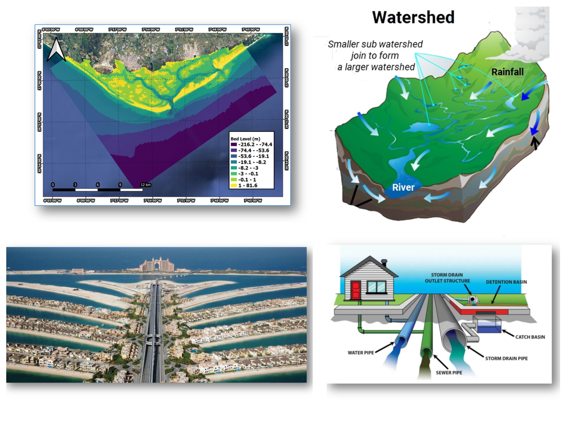
Surface Water & Hydrologic Studies
Watershed & Catchment Analysis (GIS)
Rainfall–Runoff & Flood Modeling (1D/2D)
Flood Risk Assessment & Mitigation
Urban Stormwater & Drainage Design
Hydraulic & BIM-Based Stormwater Modeling
Culvert & Cross-Drainage Design
Wadi Flood Assessment & Modeling
Wadi Flood Protection & Control
Surface Water–Groundwater Interaction
Dams & Hydraulic Structures Support
Reservoir & Detention Basin Assessment
River, Lake & Lagoon Hydrodynamic Modeling
CFD-Based Flow & Circulation Modeling
Lake & Lagoon Circulation Studies
Climate Impact & Water Balance Analysis
Drought & Surface Water Balance Studies
Surface Water Quality & Transport Modeling
100+ Years of Collective Experience
With a collective experience of 100+ years, our geophysical services team stands as a beacon of expertise. Navigating the complexities below the Earth's surface, we have honed our skills to perfection. Our multi-faceted knowledge, coupled with cutting-edge technology, ensures tailored solutions for each project. From resource exploration to environmental assessment, our impact reverberates across industries. Collaborative at our core, we work hand-in-hand with clients to achieve optimal outcomes. Our commitment to excellence drives us, making us your ideal partner for unravelling the Earth's secrets.
We Proudly Serve Saudi Arabia & MENA Region
For a Consultation or Scheduling a Training
Call us at:
+966-500497052
Interested in working together? Fill out some info and we will be in touch shortly! We can't wait to hear from you!